If you want to just skip all the writing the video is at the bottom of the page.
Ever since stumbling across a blog describing combining hiking, biking and pack rafting human powered adventures through the backcountry a few months back, I had become mildly obsessed with the idea. I purchased a couple Alpacka Packrafts and anxiously awaited warmer weather to try them out. March came and the look on the ranchers face just screamed “that boy ate sumthin what put him loco” as I floated down the irrigation canal through their land on a trial run with my bike tied on my raft.
Next up, Joannie, Topaz and I put the bikes on the rafts and had a wonderful lazy float down the lower Owens River.
It was time to step it up a bit.
Joannie had taken 2 weeks off to coincide with my days off so we could get out for an extended period. We still hadn’t decided where to go or what to do and the time was rapidly approaching. I started pouring over Acme mapper and google earth with ideas of doing a loop in the Escalante backcountry, eventually settling on the loop described below. Several days after getting off work we drove down Hole In The Rock road from Escalante Utah and cached our bikes on the bluffs above Davis Gulch. We then returned to the Willow Gulch road and parked about a half mile from the trailhead with beautiful slick rock and plateau views. A full day was devoured just doing that. We packed up the following morning and descended into the canyon. We hiked, waded, bushwhacked our way down the canyon and made camp well below Broken Bow arch early in the afternoon.
 |
Broken Bow arch  |


We made camp on a bluff above the creek, and dug a hole in the sand so that the paddle could be used for the tent pole. We did receive some showers in late afternoon.
I carried some PBR down the the canyon with me. I really tried to understand the whole PBR mystique but the closest I got was flashing back to high school days thinking I was a bad ass drinking warm beer. Guess I'm just spoiled now.
 |
Hard to see but have some PBR's cooling off in there. |
The next day started off walking in the creek and we noticed some moqui steps to nowhere. Then came some pretty thick 'schwacking. Shortly after we crossed the beaver dam we came to a beautiful little waterfall and spent some time in the shade enjoying the solitude. Eventually we made it down to lake level and it was time to blow up the rafts. We paddled the remaining distance down Willow Gulch to the main arm of Escalante river and turned downstream. It was a beautiful paddle with surprisingly little boat traffic. At Davis Gulch we hung a right and started up toward La Gorce Arch. That evening laying on our upside-down rafts for mattresses we enjoyed watching the bats swoop around our heads.

 |
Moqui steps to nowhere |

 |
Joannie crossing the active beaver dam |


 |
On the Escalante Arm |


So the next morning we had a short paddle up the remaining bit of Davis Gulch to water's end before reaching La Gorce arch. It was a bit shocking as we had in years past motored up and around the arch when the lake was much higher. We took out on a nice shady beach, packed the boats and headed up Davis Gulch intending to camp at the last known location of the lost wanderer Everett Ruess. (click the last link at the bottom of the page for a little background on Everett Ruess) Along the way we encountered a short waterfall without a bypass around it. I climbed up the fall to see how we would surmount this obstacle with Topaz. As it worked out, we harnessed up Topaz in her brand new climbing harness, I helped Joannie up the fall then tossed her a rope so she could haul Topaz while I helped from below. After Topaz was up we hauled the packs up. You gotta see the video...Anyway we hauled in to the Ruess camp early and it was the hottest day yet. I had scouted ahead earlier so we side tracked to a Maui like waterfall and cooled off. While in the shade of camp waiting for it to cool down we were amazed as a gorgeous 4 ft King snake casually cruised through camp, crossed the creek and climbed a 15 ft dead vertical sand bank. We intended to get a pre dawn start the next day for the long hot haul back out to Hole In The Rock road and our bike cache. So later that evening we scouted the cattle trail exit so there would be no mishaps in the early morning darkness.


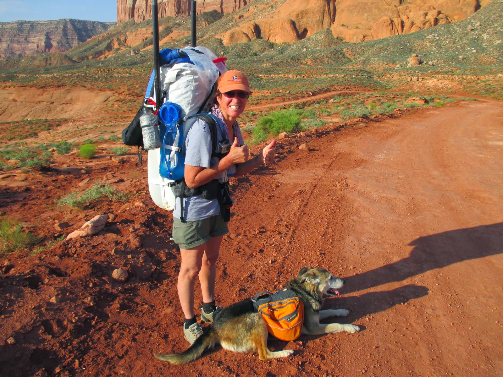
We packed up at 4 am the next morning and by 8 am we were fixing our first flat tire on our bikes. It was a relatively long ride ride back to the truck loaded as we were with our full packs. It went a bit like this: “Oh this is so beautiful, this is the way to travel” Later.. “Ok it's starting get get a little hot and tiring” Later still...”Crap its hot and I'm tired. Sure could use one of those crappy PBR's!” We took lots of breaks for Topaz and she handled it at least as well as we did. Soon enough however we were back at the truck and after cleaning up, sitting back and looking out over the terrain we traversed was very rewarding.

 |
Yep, we just crossed all that |


.jpg)

.jpg)


.jpg)

.jpg)


