In October 2023 I partnered with Kurstin aka Bikepacking Northern Nevada, aka @bikepackingnv. We'd been talking about doing a longer route through Nevada all winter, we finally made it happen. This is the route we rode: RWGPS
Prologue.
I'd like to say we fought through and overcame mega obstacles emerging out the far side wiser, stronger and better looking, due to our equally mega awesomeness. But fortunately for you, my readers, both of you, I will keep it short and...mostly truthful. We had nary so much as a single mechanical (mostly true, see day 8) and only a few moments of rain and hail. Pretty mundane stuff. The biggest near disaster was being disappointed in the fact that on day 7, Dirty Dicks saloon in the old mining town of Belmont was closed. And to illustrate how well thought out this adventure was, I was riding my titanium, Binary Bicycles Kinetik to safeguard against any possibility of the salty sweat dripping from my overheated brow causing catastophic corrosion. (Kurstin doesn't sweat so no worries there.) The route page can be found here and contains a route overview.
Day1
I picked Kurstin up in Carson City. Yep that same but matured Carson City that Hoss and Little Joe would often visit, making up lame supply needs when all they really wanted was just to get the hell off the Ponderosa and smooze with the saloon girls. But I digress. We drove out and parked in a pullout a couple miles below the old townsite of Berlin. I've yet to make it to the state park but gosh by golly I got pretty close this time. After packing our bikes we took the road that would lead up to Grantsville ghost town (lots of old ruins to gawk at) and up Grantsville canyon over the summit into Indian Valley. We picked a random spot to camp that evening after a relatively short pedaling day.
Camp 1: 38.787521, -117.505341
Day 2
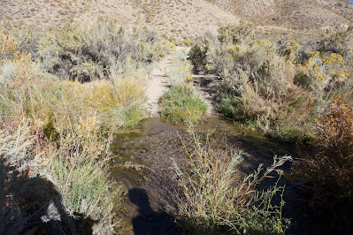
It was cold overnight. Something in the teens when we got up. I say something because we both had mini thermometers that just like our GPS devices could never agree on any data. I only know for sure that breaking camp and manipulating the aluminum tent poles or camp chairs without gloves on was a bad call. I kept the gloves handy in the coat pockets of my puffy jacket for the rest of the trip. Riding over Cloverdale summit and continuing down the good Indian Valley road we came upon the first of many abandoned ranches we would visit.
It was cold overnight. Something in the teens when we got up. I say something because we both had mini thermometers that just like our GPS devices could never agree on any data. I only know for sure that breaking camp and manipulating the aluminum tent poles or camp chairs without gloves on was a bad call. I kept the gloves handy in the coat pockets of my puffy jacket for the rest of the trip. Riding over Cloverdale summit and continuing down the good Indian Valley road we came upon the first of many abandoned ranches we would visit.
Camp 2: 38.609563, -117.299673
 |
| Abandoned homestead or ranch just before steep short hike-a-bike. |
 |
| P.C. Kurstin |
 |
| P.C. Kurstin |
Day 3
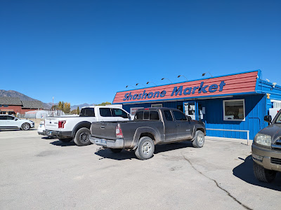
After descending out of Peavine Canyon we hung a left and easy riding along what's labeled on the maps as the Fremont Route led us north to the small town of Hadley. A company town for the the mine at Round Mountain, Hadley boasts a very well stocked market, a park and a golf course. After picking up a few non essentials from the market we rode over to the park for a lunch break. The internet in Hadley is better than what I have at my house. Leaving Hadley we continued on the Fremont route up to Carvers. Another market visit, this one more of a mini mart it did however have a make to order sandwich shop and some killer handmade burritos. Should've bought two. Like Kurstin. Be like Kurstin.
 |
| Carvers P.C. Kurstin |
 |
| Hadley P.C. Kurstin |
Now on the highway we continued north. But shouldn't have. In my haste to leave town after finding the bathrooms closed at the rest area (could've been disastrous!) I failed to pay close enough attention to the route, the plan was to have been to head south a bit and then climb up over Jefferson summit. By the time I discovered my route error we were already 10 miles out on what should've been our return route. Well shame on me we just resolved to ride this loop section backwards. It was super hot with no shade climbing up toward Charnock Pass. Technically, not completely true. The air temp wasn't unreasonable but the sun exposure was intense. Pretty sure Kurstin stopped early for the day to allow me to gracefully stop too. I'll never admit it though. You two readers keep it to yourself please.
Camp 3: 38.882842, -117.020440
 |
| Camp 3 P.C. Kurstin |
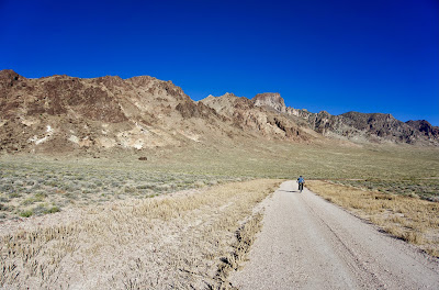
On days 1-3 we climbed over the Shoshone mtns, transited Indian Valley between the Shoshone and Toiyabe range, made an end run around the southern Toiyabe range, crossed Big Smokey Valley and started up the Toquima range.
Logistics:
Hadley- Market and water hydrant at the park
Carvers- Mini mart sandwich shop (Shoshone market) and water hydrant and restroom at the rest stop. Note restroom closed when we were there.


No comments:
Post a Comment