
I wasn't really sure what to expect out of this ride. I mean really, I've been to the “eastside” so often hiking and climbing and fishing I've sort of come to consider myself a local. In addition I had traveled hwy 395 weekly for 23 yrs commuting to and from my work on an oil platform offshore Santa Barbara. What could possibly be new and exciting here?
Although the scenery was familiar I was viewing it in a different way from many new perspectives. You get up close and personal with some of the highest peaks in California including Mt. Williamsom, California's second highest, before cruising down to Manzanar. I finally took the time to visit Manzanar though even now I didn't allow enough. I will definitely go back to explore further.


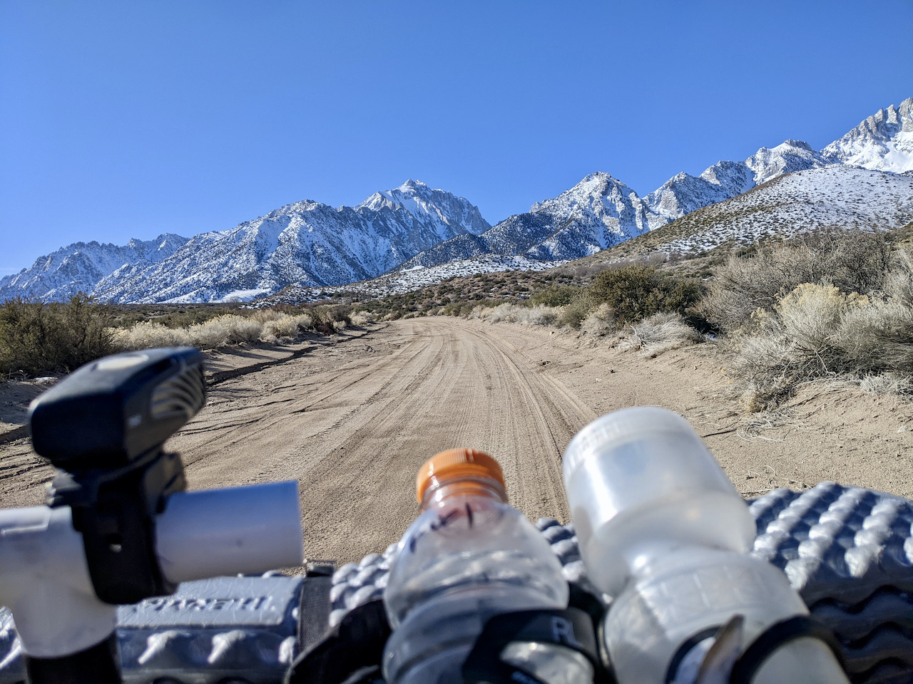


From Manzanar the route traversed some lower desert reaches before crossing Hogback creek and climbing up into the Alabama Hills National Scenic Area. Famous for all the early as well as later western movies filmed in the area and using Mt. Whitney, the Sierra and the rocky landscape as a backdrop. As many times as I'd been through the A-hills I had never taken this more scenic route. There are plenty of areas to camp here but as with most popular areas, it has suffered from over use and new camping regulations are in effect. See here. I continued on and finally traversing the hills and descending a sandy wash I found myself back on pavement on Whitney Portal road at the aptly named Nightmare Rock.


A fast paved descent took me into Lone Pine. A great place to top up your water and find a meal. Pro tip: The dog park at the north end of town adjacent to the city park and basketball courts (Spainhower park) has water available year round.
The route then heads out to the east
side of the valley where I eventually made a camp. The east half of
the route follows some old roads, abandoned rail beds and some
pavement back into independence. Views of the Sierra are still
spectacular and a highlight of the route for me was detouring up to
the Reward Mine for a bike ride through a mine tunnel. I stupidly
didn't look at my GPS while making the trip up to the mine. I
continued pushing up Eclipse canyon even after I knew I was going the
wrong way. Why? Probably because I'm a pretty ridiculous person and
this was definitely a ridiculous push. Don't do it. Seriously, don't do it. If you have to explore the mining remains up there leave your bike below, you'll thank me later. I made my way
back down and around to the correct canyon and up to the tunnel entrance. This is a must do on this
route. Where else can you ride your bike through an abandoned mine? Luckily I didn't have to share my tunnel ride with any of the
jeepers that like to drive into the tunnel. (See video clip below.) I ate lunch on the tailings dump then rode on. After a minor wrong turn I stopped again at the
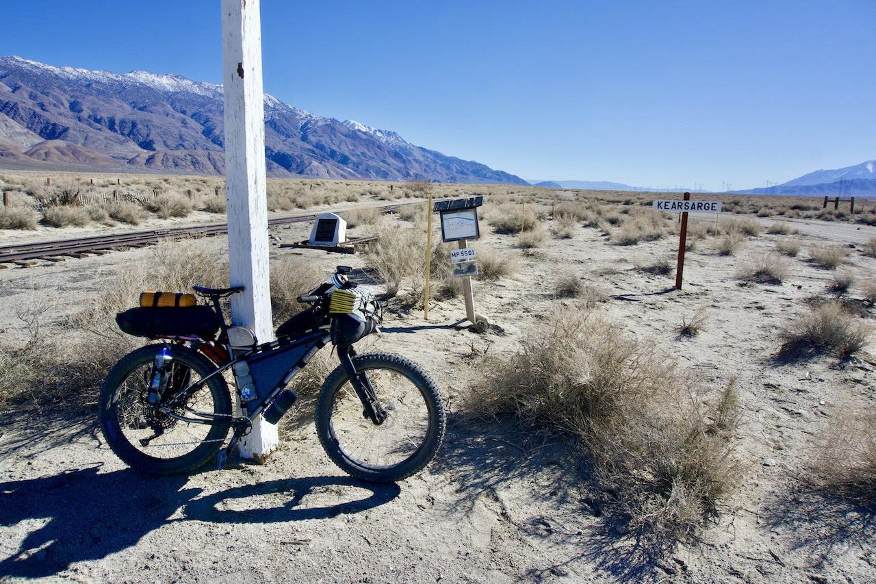
historic Kearsarge station, originally a stage stop and then
transitioning into a rail stop. It was just a few short miles later
and I was back to my truck. Traveling by bike can make everything new and exciting!


I went in early February sunshine and
found the daytime temps perfect for riding and night time temps
hovering around the freezing mark. The route was in good shape after
a series of intense winter storms that brought mega snow totals to
the Sierra. Snow level was just above ride level at the western edge
of the route and never presented a problem. You can find the route on Bikepacking.com here.
Bike setup