
August 2024
I wanted to do the Mt. Patterson section of the Caldera 500 route. I cherry picked a week when the heat backed off a bit but was still high summer. Knowing that the climb all the way to the summit involved mostly pushing vs riding I packed fairly light and carried a pack with a bladder to keep most of the water weight off my bike. Going light gave me an opportunity to use the "Louise" dropper post compatible seat bag harness that I've had for a year but never used. I found an 8 liter dry bag for it in my collection and it worked perfectly in the harness.
I wanted to do the Mt. Patterson section of the Caldera 500 route. I cherry picked a week when the heat backed off a bit but was still high summer. Knowing that the climb all the way to the summit involved mostly pushing vs riding I packed fairly light and carried a pack with a bladder to keep most of the water weight off my bike. Going light gave me an opportunity to use the "Louise" dropper post compatible seat bag harness that I've had for a year but never used. I found an 8 liter dry bag for it in my collection and it worked perfectly in the harness.
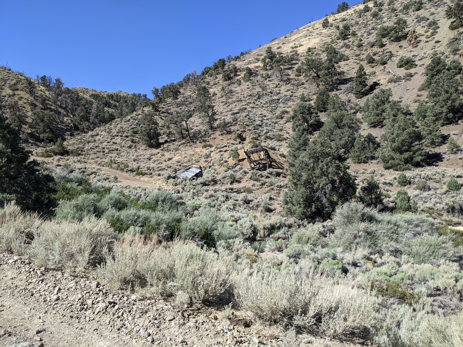
Leaving the house early I was at the trailhead and ready to ride shortly after 7am. I wanted an early start to beat the heat and get some elevation before the heat did set in. The first 8 miles went quickly but soon after the hike-a-bike began. Not only was it steep, but it was loose and very chunky as well with intermittent deep ruts in the road. A bit of riding and lots of pushing saw me to the former site of Starr City at approximately 8500 ft elevation. Starr City was a small mining camp of the Mt. Patterson district. Looking ahead I thought I had some ridable terrain but it was very short lived. Back to pushing. This was the toughest pushing of the day. VERY steep, I saw 19+% on my bike computer a LOT. That said I was going so slow the computer didn't register some of the route. I think the GPX file shows 23%. It took me almost 2 hrs to push up the remaining 1.75 miles to Belfort and Boulder Flat. There is some discussion on which location is which but I'm just going with what the map shows and calling the first cabins encountered Belfort. It wasn't late by the time I had reached Belfort but I wanted to do a little exploration of the area and was perfectly happy to discontinue pushing for the day and make camp at a perfect level area 150 yards or so away from the cabins. And I did. I spent the remainder of the afternoon hiking up a small peaklet and poking around the cabins. These guys had one hell of a view! There is a newish sign on one cabin stating the elevation (10,200 ft) and the timeline of the mining activity. It was quite windy all night and although it was a couple extra pounds of weight to push up the mountain, I was now happy I brought my tent. It almost didn't make the cut.


Packed and ready to go the next morning I rode back to the cabins, turned, rode a few more feet, jumped off my bike and resumed pushing. I reached a saddle where some steep switchbacks dropped off the back down to a creek. This was mostly rideable but even here I hopped off my bike for one exceptionally loose off camber switchback. I rode to where again the main track shoots straight up the slope, but old mostly unused switchbacks exist. I pushed the first straight shot but it was SO steep and deeply rutted that as soon as I hit the next switchback I took it. This was infinitely better and even though this route seems to be unused by the off road crowd it was somewhat rideable! I continued this way to the ridge at 11,500 ft. on the shoulder of Wheeler Peak. The next 1.5 miles was mostly rideable until just a couple hundred feet below Mt. Patterson's summit. I have to say the summit of Patterson provides one of the best views of any peak I've summited, and I've summited more than a few. Remember, I was a climber once upon a time... The wind was howling but temps were reasonable enough that I was in no hurry to leave. It was crystal clear and I could see forever! Eventually it was time to leave though. Descending was non-trivial. The first 1600 ft was the same steep, loose, rutted conditions I had pushed up through but it was all carefully rideable. Pro-tip: lot's of judicious use of the front brake is your friend. Skid the rear and you're down. My Binary Kinetik handled it just fine. Down in friendly canyons now I stopped to refill water. A couple dirt bikers went by for the first people I had seen. I knew that there was some climbing still to come on the way down but I mistakenly thought it was all easy from here. After the climbing I came to Wildhorse spring and the Spring canyon descent. Techy, bushwhacky, route finding. That's all I'll say. But I didn't get to Walker until after 3pm. I was hot and in no mood to ride another 10 miles to find a camping spot with no shade. I got a room at the Historic West Walker Motel. Very very nice room! I cooled off, took a shower and walked over to Walker Burger. Man that first burger was good! Later, back in my room, the second was just as good.
 |
| Small pond at the top of a saddle just beyond Belfort |

 |
| Mt. Patterson summit. |
 |
| Sawtooth Ridge above Bridgeport in the distance |
 |
| The patio at Walker Burger! |
So after a good night I got an early start for the 25 miles and 3000+ ft of climbing back to where I parked on the other side of the mountains. I adjusted my route to just follow Risue canyon road. I think it was a good choice as it seemed more scenic than my original route and had more time along Desert Creek. I even noticed a shallow cave on the opposite canyon wall that I dubbed a bandit hideout, haha! It was bliss to be riding my bike instead of pushing it! I passed some old mining ruins, went over a saddle, pedaled along beautiful Desert Creek, climbed over another saddle and before I knew it I was back to my truck mission accomplished.

 |
| Some mining ruins in Risue Canyon |
 |
| Desert Creek flowing well. |
Video Link
Stats: 66.2 miles. 9439 ft of climbing. 2.5 days.
Bike Setup: Binary Kinetik 29+ (29x3.0 tires) hardtail. Full bikepacking bags.
Logistics: Once leaving the valley floor from hwy 338 there is no water until about a half mile beyond Belfort at a pond. A short distance beyond the pond, at the bottom of the switchbacks is a running creek. Bring enough water to reach these areas and a filter. There is a store and a couple places to eat in Walker if they're open. The return leg has no reliable water until Desert Creek which is about 18.5 miles from Walker.
Map and downloadable track: https://ridewithgps.com/routes/48031808
Always enjoy reading the story of your adventures
ReplyDeleteThanks!
Delete