
In October 2023 I partnered with Kurstin aka Bikepacking Northern Nevada, aka @bikepackingnv. We'd been talking about doing a longer route through Nevada all winter, we finally made it happen. This is the route we rode: RWGPS
Day 4
The night skies over Big Smokey Valley had been spectacular. But with dawn came the urge to get moving. Water sources were not a sure thing going up toward Charnock pass. I had picked some out from the map and sure enough a full trough of only slightly foul water met us when we reached our waypoint at Harmon Spring. It was a nice break resting and filtering for a half hour or so and from the spring it was only a short climb to the summit. A fast scenic downhill took us down to Monitor Valley.
The night skies over Big Smokey Valley had been spectacular. But with dawn came the urge to get moving. Water sources were not a sure thing going up toward Charnock pass. I had picked some out from the map and sure enough a full trough of only slightly foul water met us when we reached our waypoint at Harmon Spring. It was a nice break resting and filtering for a half hour or so and from the spring it was only a short climb to the summit. A fast scenic downhill took us down to Monitor Valley.
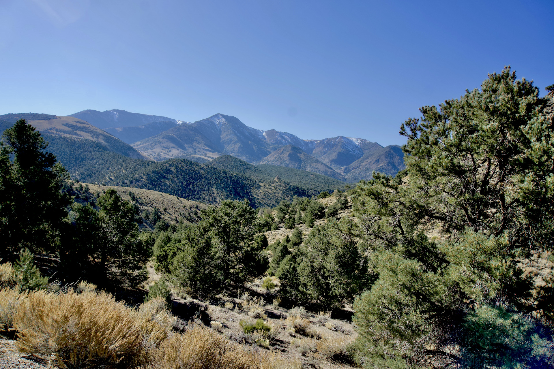


I had been looking forward to this route section. Diana's Punchbowl and Pott's Ranch. For reason's unknown even to myself I have wanted to ride my bike out to Pott's Ranch and hot springs for a number of years. Even though the hot springs has been closed and tubs removed by the property owner I still wanted to visit. But, first! Diana's Punchbowl. Rather than regurgitate all the facts about this unique feature you can read about it here. We were alone on our visit but somewhat comedically someone had lowered a deer decoy into the pit and set it up!

 |
| Note the deer decoy |


 |
| P.C. Kurstin |
From Diana's Punchbowl more easy riding took us to Pott's Ranch. The abandoned Pott's Ranch. A nice creek runs through and it provided a good opportunity to wash some of the sweat and grime accumulated from the last few days. At our camp spot, we were served up pies, cow pies. Lots and lots of cow pies. All you could, well, move, to clear a tent spot. We didn't go down to the hot springs but I finally did get to ride to Pott's! Yay!
Camp 4: 39.087701, -116.638778


 |
| P.C. Kurstin |
Day 5
The big day. Over 50 miles and 2 passes to cross. The goal was to get to Moore's Station, an old stage station on the Belmont-Tybo-Eureka stage route. Another point I was eager to ride to. I've seen great pictures online and was really looking forward to it. Descending from Dobbin summit, the first pass of the day which crossed the Monitor Range, we went by what was labeled on the maps as the "miniature Grand Canyon." It was very scenic but perhaps a bit over billed with that comparison. We stopped at Clear Creek ranch, abandoned of course, to pick some apples off a lone tree bearing tons of fruit. Kurstin pointed out the fact the local wildlife was well aware of the tree as it was nicely trimmed to about deer head height. It bears noting here that all these abandoned ranches we were passing does not mean they weren't privately owned. Some showed evidence of recent work whether fencing or work to arrest decay, or as staging area for materials the owners were using elsewhere. From private land ownership maps it looks as if corporate ownership has taken over much of the land.


 |
| P.C. Kurstin |
An indistinct 2 track took us down to the valley floor. Then began a sandy, weedy overgrown climb up toward Tod Wattle summit. Higher, the road? track? whatever, was only vaguely there. Over the summit and down Luther Waddles wash the track was similar, maybe worse.


 |
| P.C. Kurstin |
 |
| P.C. Kurstin |
 |
| P.C. Kurstin |
 |
| P.C. Kurstin |
 |
| P.C. Kurstin |
In due time we made it down to a better road and then it was a fast moderate downhill to Moore's. Unfortunately my hopes of visiting a beautiful old stage stop were dashed due to the current owners having the entire grounds locked up tight. Couldn't even see through the fence and trees enough for pictures...sigh. We were starting to lose the light now so we slowly rolled down the road looking for a suitable place to camp.
Camp 5: 38.684482, -116.183577
Day 6
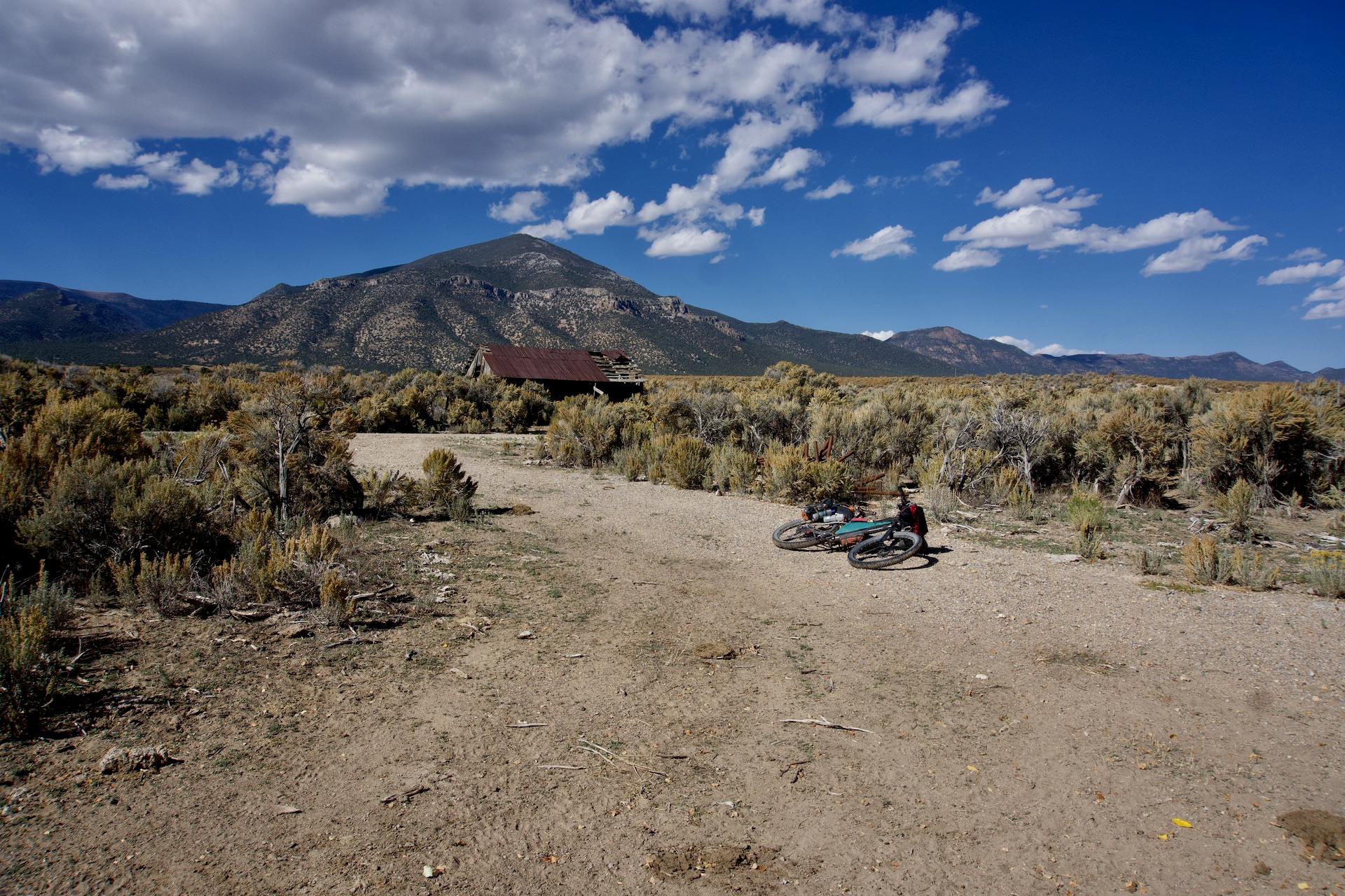
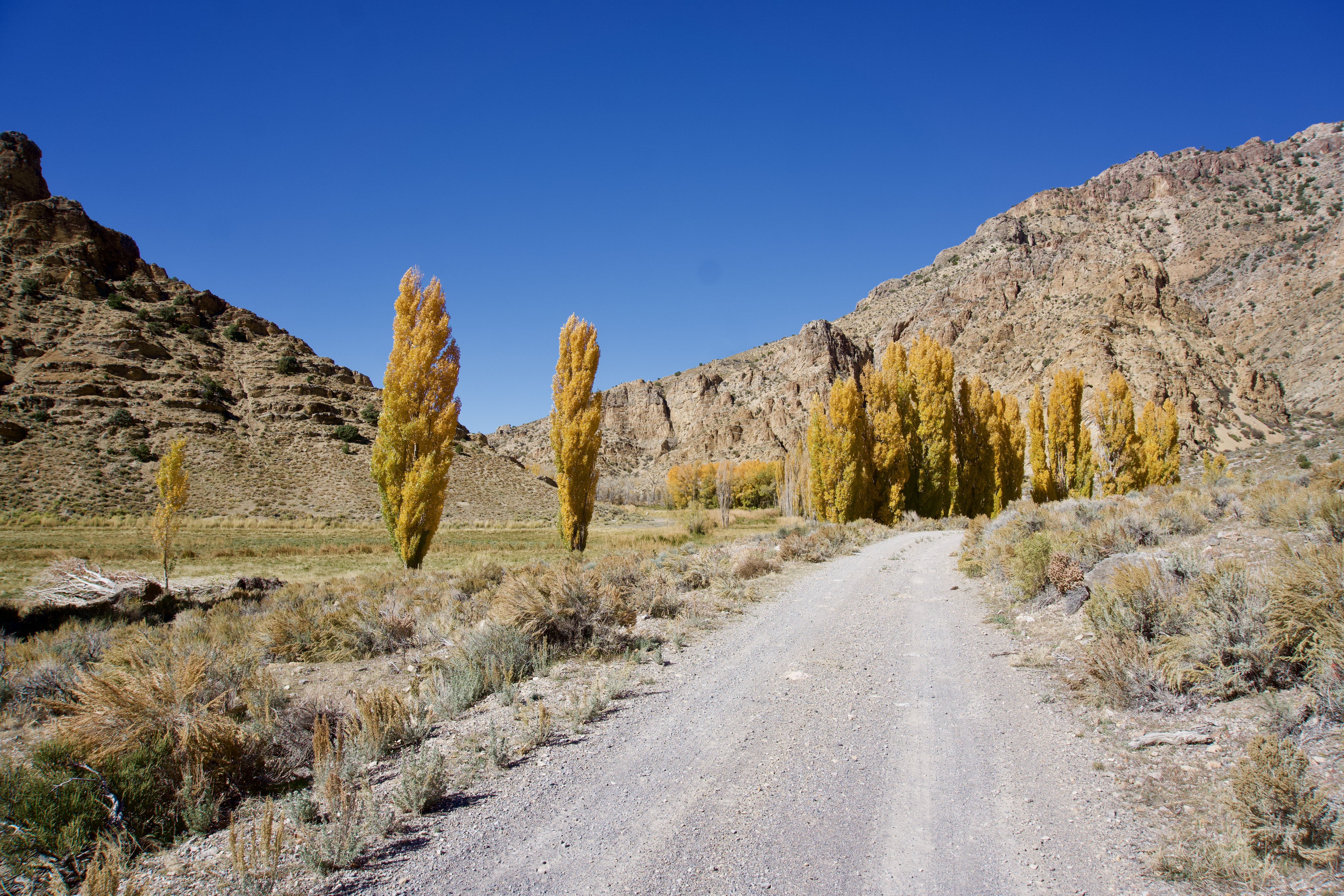
Moore's was sort of our unofficial turning point. We would now begin looping back south and west. Today's route was along the eastern flank of the Hot Creek Range before climbing up Hot Creek canyon and eventually via another vague 2 track up over Eagle Pass. The rancher I chatted with briefly didn't think the road over Eagle Pass was used anymore. It was quite passable but rough and very steep the last half mile or so. Even Kurstin had to push. I tried to get a photo of him pushing cuz you know, pictures or it didn't happen. Unfortunately he had gained enough ground before hand that I couldn't catch him for the photo ops. So maybe it didn't happen? (I think it did.) But I'm getting ahead of myself (pun intended). Back down where we started climbing up hot creek is the the old mining townsite, which became Hot Springs Resort, now a private ranch. The historic hotel can still be seen. Riding up Hot Creek Canyon was extremely scenic and we even visited the old cemetary. Hot Creek canyon is definately worth further exploration. The night was passed in a random location west of Eagle Pass. It was weird though. It seems we were camped directly below a major north-south commercial airline corridor. No sooner would the noise from one jet fade than another would start up. Constantly. All. Night. Long. I gave up and used ear plugs around midnight. I'm going to create a new metric by which to evaluate this particular factor of a potential camp spot. Overhead Air Traffic Anoyance Factor - OATAF. This camp had an OATAF of 9+. Thankfully the beauty of our surroundings muted the OATAF.
Camp 6: 38.531357, -116.568465
 |
| Camp spot near Moore's station. |


 |
| P.C. Kurstin |
 |
| P.C. Kurstin |
 |
| Camp west of Eagle Pass. High OATAF factor. P.C. Kurstin |
Day 4 - 6 We crossed the Toquima Range, made a long transit north through Monitor Valley before crossing it. Then made our first crossing of the Monitor Range and crested our high point of the trip at Dobbin Summit, dropped into and crossed Little Fish Lake Valley, made our first crossing of the Hot Creek Range, transitted Hot Creek valley south and made our second crossing of the Hot Creek Range.
Logistics: No resupply in this section.
No comments:
Post a Comment